|
|
|
||||
 & Christine Armour, Forth Bridge, Edinburgh)")
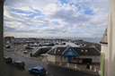
| GPS Location: |
|
| GPS Coordinate: | 56.222738333333,-2.699765 |
| GPS Altitude: | 33 feet (above sea level) |
| Date Taken: | Sunday, July 6th, 2014 - 08:56:15 AM |
| Filename: | IMG_1477.jpg |
| Category: | 2014 Europe Trip Day 33 - Scotland (Scottish Rapeseed Fields, Church in Kirkcaldy, Lunch w/ the Lairds, Paul describes the Loch Ness Monster, Kirkcaldy Missionary Flat, Dinner w/ John Armour (Crookston Cousin) & Christine Armour, Forth Bridge, Edinburgh) |
44486