|
|
|
||||
")
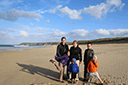
| GPS Location: |
|
| GPS Coordinate: | 58.361928333333,-6.2097033333333 |
| GPS Altitude: | 51 feet (above sea level) |
| Date Taken: | Wednesday, July 2nd, 2014 - 07:53:05 PM |
| Filename: | IMG_0487.jpg |
| Category: | 2014 Europe Trip Day 29 - Scotland (Callanish Standing Stones, Dun Carloway Broch, Gearrannan Blackhouse Village, Harris Tweed Weaving Loom, Dailbeag Beach, Arnol Black House, Breanish Tweed, Peat, Steinacleit, Bridge to Nowhere, Traigh Mhor, Rainbow) |
43500