|
|
|
||||
")
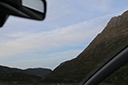
| GPS Location: |
|
| GPS Coordinate: | 57.939393333333,-6.8243816666667 |
| GPS Altitude: | 435 feet (above sea level) |
| Date Taken: | Tuesday, July 1st, 2014 - 09:32:46 PM |
| Filename: | IMG_0037.jpg |
| Category: | 2014 Europe Trip Day 28 - Scotland (Isle of Skye, Portree, Full Scottish Breakfast, Dun Beag Broch, Highland Sheep, Thistle, Red Telephone Box, Neist Point Lighthouse, Dunvegan Castle, Uig-Tarbert Ferry, Outer Hebrides, Isle of Harris, Losgaintir Beach) |
43055